Hiking Incline Calculator
Convert rise, run, trail distance, elevation gain and loss, pack weight, terrain surface, grade mode, and descent style into grade, angle, vertical gain per mile, and equivalent flat distance.
📌Trail Presets
Each preset fills a complete hiking incline profile with unit system, hiker context, rise, run, route distance, total gain, loss, pack load, surface, and descent assumptions.
⚙Calculator Inputs
Hiking incline snapshot
Enter a hiking profile to convert grade, angle, gain density, descent load, and flat-equivalent effort.
📊Fitness Metrics Comparison
📑Reference Tables
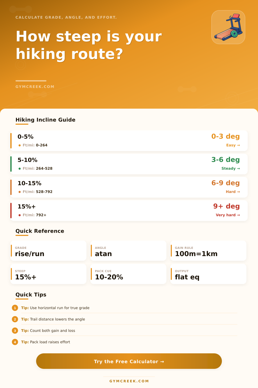
| Grade band | Angle | Trail feel | Planning cue |
|---|---|---|---|
| 0-5% | 0-2.9° | Easy incline | Distance and pace dominate. |
| 5-10% | 2.9-5.7° | Steady climb | Breathing rises; poles may help. |
| 10-15% | 5.7-8.5° | Hard sustained grade | Expect shorter strides and breaks. |
| 15-25% | 8.5-14.0° | Very steep hiking | Footing and descent matter a lot. |
| 25%+ | 14.0°+ | Scramble-like effort | Use caution; grade alone understates risk. |
| Vertical gain density | Equivalent | Common feel | Use |
|---|---|---|---|
| 0-250 ft/mi | 0-47 m/km | Gentle rolling route | Beginner-friendly pacing. |
| 250-500 ft/mi | 47-95 m/km | Moderate trail climb | Good steady hiking benchmark. |
| 500-800 ft/mi | 95-152 m/km | Hard uphill route | Climb fitness becomes important. |
| 800-1200 ft/mi | 152-227 m/km | Very steep mountain day | Plan slower pace and more stops. |
| 1200+ ft/mi | 227+ m/km | Extremely steep | Check exposure, footing, and descent. |
| Formula | Calculation | Best input | Result |
|---|---|---|---|
| Percent grade | rise / horizontal run x 100 | Surveyed segment or map run | True incline steepness |
| Angle | atan(grade / 100) | Percent grade | Slope angle in degrees |
| Vertical density | gain / route distance | Total elevation gain | ft/mi or m/km comparison |
| Flat equivalent | distance + gain/100m + descent add | Total route profile | Comparable effort distance |
| Climb multiplier | flat equivalent / distance x terrain x load | Full route and pack | Relative effort factor |
| Surface | Factor | Why it changes effort | Typical caution |
|---|---|---|---|
| Paved or smooth path | 1.00 | Predictable footing | Grade is the main limiter. |
| Packed dirt singletrack | 1.06 | Minor turns and unevenness | Still close to planned pace. |
| Rocky rooty trail | 1.12 | More foot placement work | Downhill speed drops. |
| Loose gravel or sand | 1.20 | Energy lost to slipping | Use conservative effort estimates. |
| Mud, snow, talus, off-trail | 1.30 | High balance and traction demand | Grade alone may understate effort. |
💡Tips
A hiking incline calculator will allow you to understand the effort that is require for your hike. A number on the maps does not always indicate the effort that an individual will experience on the hike. A hiking incline calculator consider several different factor regarding the hike to calculate the total effort that will be required for the hike.
Factors like flat-equivalent distance allow you determine the distance that would be required for a flat path to equal the total effort of the hike with all of it difficulty. One of the factors that a hiking incline calculator considers is the grade of the trail. A grade of ten percent is typically consider to be a steady grade that is manageable for most people on a hike.
What a Hiking Incline Calculator Tells You
A grade of more than fifteen percent, however, is often consider to be a steep grade that may allow for shorter step to be taken by the hikers along the trail. Hiking incline calculators often calculate the grade of the trail as an angle to help individuals understand the steepness of the trail. The steepness of a trail is often a helpful factor in providing individuals with an estimate of the physical effort that must be perform on such a trail.
Additional factors that a hiking incline calculator may consider include the total amount of elevation gain that the hikers must perform on the trail, the total amount of elevation loss that is to be performed on the trail, and the degree of difficulty in descending the trail. Each of these factor can contribute to the total physical effort that must be perform by the individuals on the hike. For instance, descending a steep trail can lead to the same amount of physical effort and stress place upon the knees as climbing that same trail.
The inclusion of these factors in the calculation of the hiking incline calculator ensure that the effort calculation is an honest reflection of the total effort that will be required of the hikers on such a trail. Factors like grade, total elevation gain, total elevation loss, and descent difficulty are just some of the factor that are considered by the hiking incline calculator. Other factor that are considered by hiking incline calculators include the weight of the individual’s hiking pack.
The heavier of a hiking pack may lead to an individual placing more effort into the walking of each step upwards on the trail. The ratio between an individual’s total pack weight and their body weight can help to determine if the pack weight is light, moderate, or heavy in relation to the terrain that they are to hike. Other factor into consideration by hiking incline calculators may include the total amount of effort that must be spent on each surface on the trail.
For instance, an individual may be able to travel quick on packed dirt, but may require more effort to travel on sandy or muddy terrain. Each of these surface type can have multipliers that are applied to the hiking incline calculator to make allowance for these different surface types. The flat-equivalent distance is one of the most important measurement output by a hiking incline calculator.
The flat-equivalent distance allow an individual to understand the total effort that must be applied to hike the trail of their choosing in comparison to a flat trail of the same distance. If the flat-equivalent distance is higher than the actual distance of the hike, the hike will require more time, fuel, and rest break than a similarly-lengthened hike that occur on a flat surface. The flat-equivalent distance allow individuals to compare the total effort of two different trails.
Hiking incline calculators allow individuals to more easy make decisions regarding which trail they will hike based off the energy that they have to expend and the amount of time that they have to hike the trail. Other factor that hiking incline calculators may consider may include the fitness level of the hikers that will be on the trail, as well as the time that they will be able to move along the trail. An individual that is more physically fit will be able to hike at a faster rate than an individual that is not as physically fit.
The hiking incline calculator can be adjusted to include the fitness level of the individual that is to hike the trail. Additionally, hiking incline calculators include information regarding the vertical speed that will be require of the hikers, as well as the moving pace that they should exhibit while hiking along the trail. Individuals may make a mistake in assuming that all gain in elevation are the same.
Hiking incline calculators, however, account for the fact that a gain in elevation of a thousand feet over two mile is different then a thousand feet over eight mile. Instead, the hiking incline calculator can help individuals to understand the amount of vertical gain in miles that is to be performed on the trail. Such information can allow individuals to understand if the trail will remain within a moderate range of elevation gain, or if it may include some steep descent or ascent portion of the hike.
In addition to the fact that many trail include physical obstacles like rocks, mud, roots, or snow, hiking incline calculators can include a multiplier for those included obstacle. The hiking incline calculator will ensure that individuals are aware of the additional effort that will be required to hike over those obstacle. Thus, the hiking incline calculator will remove any uncertainty regarding the total effort that will be required to hike each of the trail that are being considered.